In 1985, Gawler’s population doubled. This was not due to a sudden enthusiasm for making babies, but because the Gawler Council had successfully petitioned the Government for boundary reform, increasing its land area and population.
Normally, this would be part of my regular blog where I cover what happened during Gawler election years, but this event was too large and had to be split out, so I’ll be covering the rest of 1985 later in a separate post.
I couldn’t find any boundary comparison images in the historical record, so I’ve created my own for you.
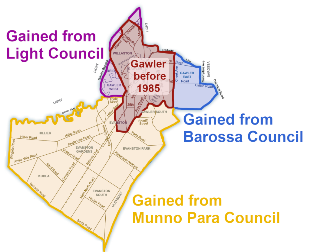
As you can see, this led to the creation of the boundary we have today, which I like to refer to as the “sideways-facing dog”. To address these one at a time:
In red: the pre-1985 borders of the Gawler Council. These old boundaries had been in place for over 50 years (since 1933, when it merged with Gawler South Council).
In purple: Gawler gained the suburbs of what are now Gawler West and Reid from Light Council, along with the remaining parts of Willaston that weren’t already within the Council boundaries.
In blue: The dog’s snout here is the chunk of Gawler East that was previously in the Barossa Council – namely, everything past Cheek Avenue. In the current day, this area hosts the ever-growing Springwood Estate development.
In gold: The most substantial addition to Gawler, previously in the Munno Para Council. This includes Evanston, Evanston Park, Evanston Gardens, Evanston South, Hillier, and Kudla. It also takes in part of Gawler South and some small chunks of Bibiringa and Uleybury.
A History of Advocacy
The 1968 Gawler Council elections would see two future Mayors face off for the title of Mayor of Gawler: Bruce Eastick and Cecil “Cec” Creedon.
They were from opposite sides of politics: Eastick, a Liberal, would later spend 23 years as Gawler’s local MP, whereas Creedon would go on to spend 12 years in the South Australian Upper House, representing the Labor Party.
Despite this, they did agree on one thing:
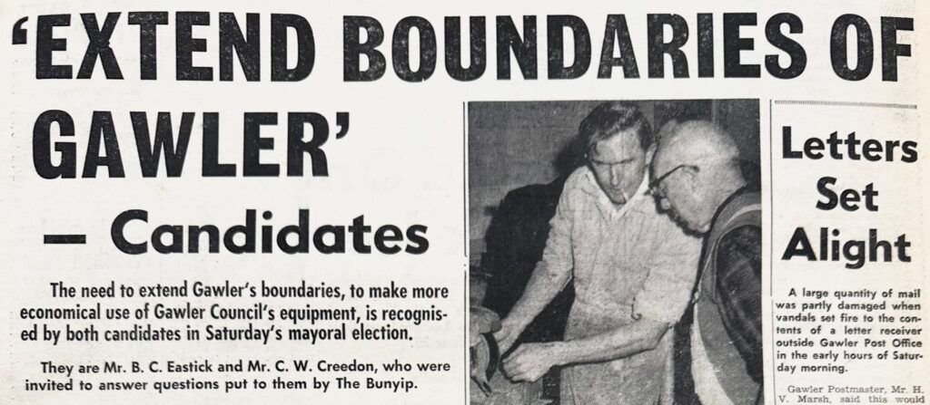
The Bunyip Newspaper, July 3rd, 1968.
This boundaries issue had been bubbling under the surface for years. In the early 1950s, Gawler’s “country town” status had seen its first major threat in the form of the new City of Elizabeth, and urban development had only continued to creep from there.
Unfortunately, without the State Government coming to the party, there was no official path forward. This would all change in April of 1973.
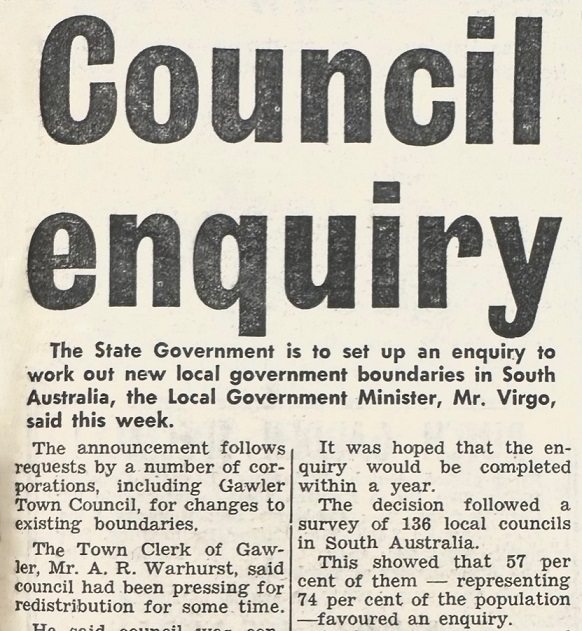
The Bunyip, April 4th, 1973.
The Minister for Local Government, Geoff Virgo, announced that a Royal Commission would be formed to determine local government boundaries, noting that the last time South Australia had reviewed its Council boundaries was in 1929, over 40 years earlier; since then, development had occurred and populations had shifted.
Gawler was quick to respond; by June, Gawler’s Chamber of Commerce had launched its own committee to draft submissions for the Royal Commission.
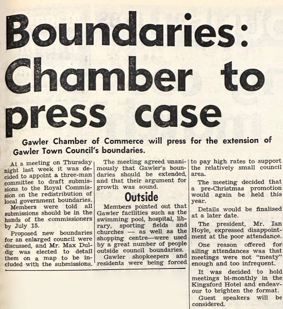
The Bunyip, June 20th, 1973.
The Chamber of Commerce presented an economic case for the boundary changes: Gawler’s local businesses and residents were paying higher rates due to inaccurate boundaries.
This is the primary financial question of boundary reform: regarding the residents and businesses in Gawler’s satellite areas (i.e., Gawler East residents who live outside the Council boundary), do they pay their rates into their own local community? Or are those rates going elsewhere due to out-of-date boundaries that haven’t been reviewed in decades?
If these satellite suburbs are functionally part of Gawler, but their rates go to other Councils, the Chamber of Commerce argued that current Gawler residents and businesses (including themselves) have to pay for a disproportionate amount of the town’s maintenance.
A few months later, Gawler Council would send its own boundary submissions to the Royal Commission:
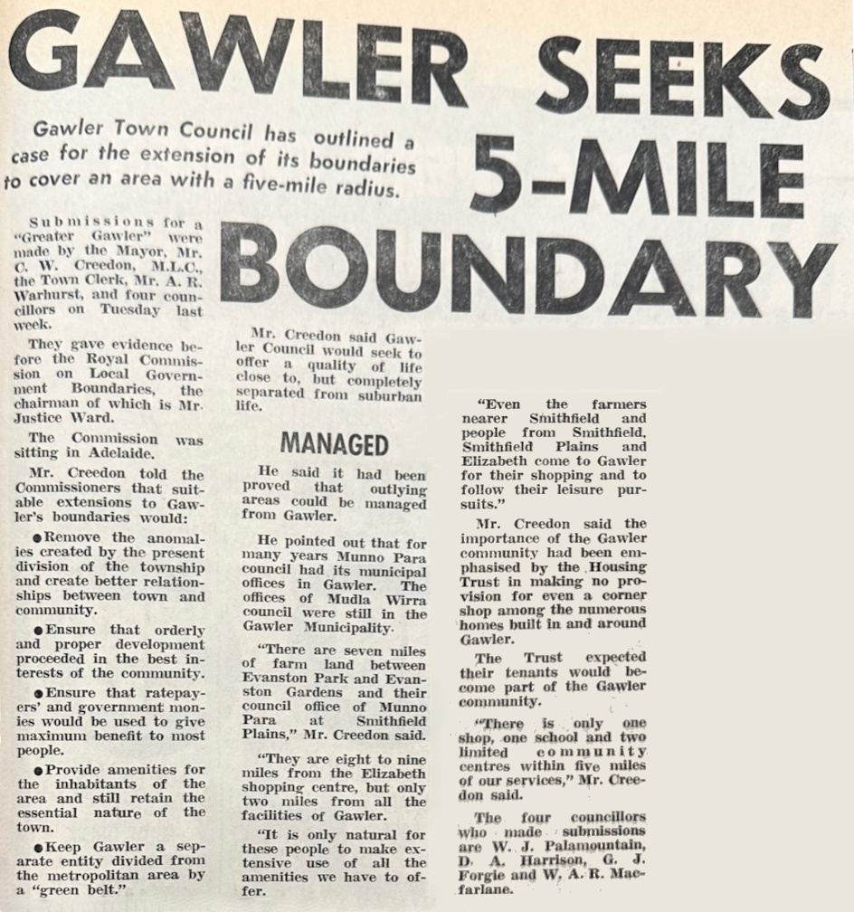
The Bunyip, November 7th, 1973.
Rather than a group submission, it seems that the Town Clerk (i.e., what we used to call the CEO), the Mayor, and four Councillors all submitted to the Commission separately.
This five-mile boundary idea was simpler than the version we would eventually get, but it got the point across – give us space! Don’t let us suffocate!
Boundary reform was an area of passion for Mayor Cec. Creedon, but it would not be under his Mayoralty that it would succeed. In his final meeting as Mayor in 1978, he declared his disappointment in how the boundary process had already dragged on for another five years since his 1973 submission.
“Gawler is important to the State’s history and should continue to thrive as an independent body and not as part of some district council where the name would not be perpetuated… I hope the new Council will be more successful than we in the past have been.”
That torch would be passed to the next Mayor, Gil Harnett, who took over in 1978 and would be the one to oversee Gawler’s eventual success in the boundary process.
Welcome to Greater Gawler
The boundaries decision from the State Government came in 1984. The Legislative Council Select Committee that had investigated the issue concluded that the community of the Town of Gawler had spilled past its existing boundaries and that its borders should be enlarged to reflect the ‘community of interest’ that relied on its facilities and services.
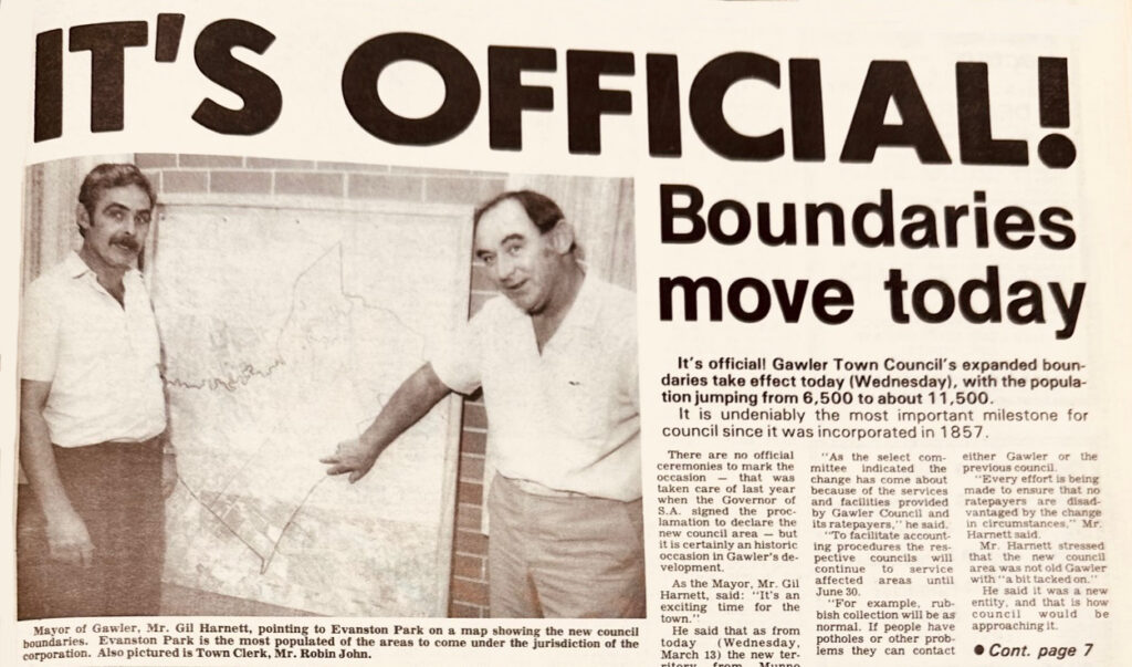
The Bunyip Newspaper, March 13th, 1985.
Here, we see Mayor Gil Harnett celebrating the new Council boundaries, which officially changed in March 1985. He noted that Gawler’s internal population had mostly stalled in recent years but that there had been a lot of growth at its borders (which were now in the new Council area).
Even to this day, most of Gawler’s growth has been in the new parts of the Council (mostly the Evanston suburbs, though the Springwood Estate in the gained part of Gawler East is also notable), so it seems that it was good forward-thinking to make boundaries such a high priority. Without this change, I suspect Gawler would have been overwhelmed by now and simply merged into another Council.
But how did the new residents of this ‘Greater Gawler’ feel about it all? The Bunyip asked Munno Para Council’s ward representative for Evanston, a young fella named Tony Piccolo, to find out.
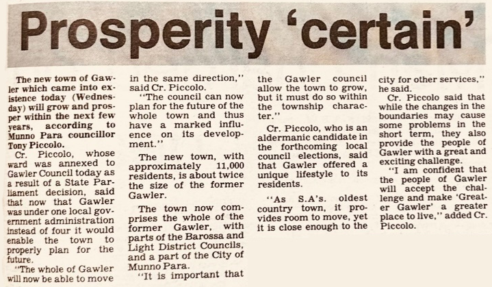
The Bunyip, March 13th, 1985.
This positive response to the news wasn’t a surprise – Piccolo, aged 25, had recently featured in a long public dispute between himself and the Chairman of the Munno Para Council about what he considered their poor treatment of his ward area. We’ll look into that more comprehensively in a later post when this blog covers 1983.
As a summary for those from outside Gawler, Tony Piccolo would go on to become a Gawler Councillor and then Mayor, eventually becoming the local state Member of Parliament, where he remains to this day. This boundary change was what moved him from the Munno Para Council to the Gawler Council.
The Boundary Backlash
Of course, not everyone was happy. The City of Munno Para did not take the news well. In 1984, they even briefly decided to stop their Council services to the affected area in protest.
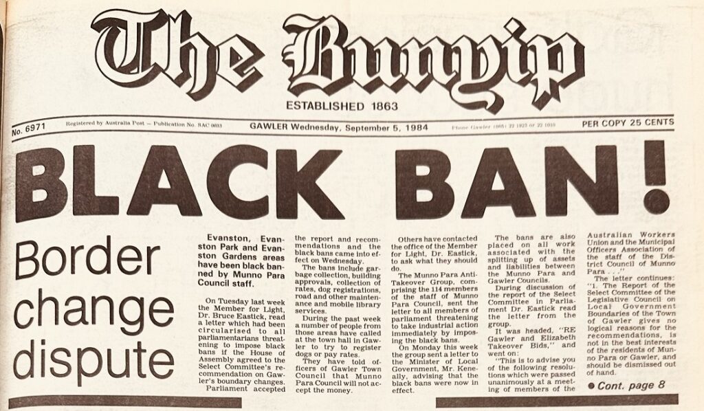
The City of Munno Para decided to treat the Evanston part of its Council as if it didn’t exist – no garbage collection, no road maintenance, and no collection of rates. This protest only lasted a couple of weeks before the Minister for Local Government intervened; still, it’s clear that these boundary changes happened very much without the support of the Munno Para Council, which felt hassled by a history of boundary requests from different Councils.
In this case, Gawler was not Munno Para’s only problem. The City of Elizabeth was also involved in a boundary dispute with them, and both debates had been happening for years – here’s an article from nine years prior, in 1976:
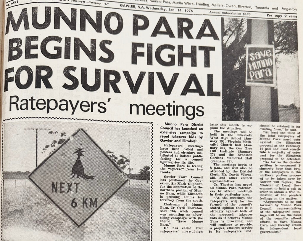
The Bunyip, January 14th, 1976.
The Munno Para Council was defiant from the very early stages of the process. In the face of multiple boundary proposals targeted at it, Munno Para quickly launched into a defensive war to whip up outrage among its residents. Elizabeth’s bid would not succeed in the short term, but by 1997, their issue would be solved by the Munno Para/Elizabeth Council merger that created the City of Playford.
The momentum for that merger had already picked up by the ’80s. When the news of Gawler’s boundary decision came out in 1984, Cr Tony Piccolo brought it up as strengthening the case for Munno Para’s amalgamation.
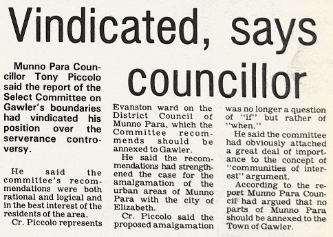
The Bunyip, August 22nd, 1984.
Munno Para’s reaction to these boundary proposals was in many ways unsurprising – of course it would feel defensive about being “squeezed from both ends” like this. And yet, Gawler and Elizabeth’s actions also made sense – after all, addressing such major structural problems from a bigger-picture perspective would inevitably be a feature of any competent 20-year plan.
Munno Para was not the only affected area with complaints. Boundary reform had also been met with letters to the editor, like this one from an unhappy resident on the Light Council side of Willaston.
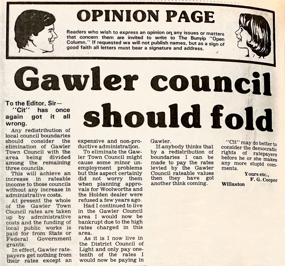
The Bunyip, June 22nd, 1983.
This is a significant misunderstanding of how rates work, so I sincerely doubt this resident’s rates increased by ten times. Still, it’s a useful indication of the types of fear that can spread when this kind of change occurs.
While Munno Para (as a Council body) opposed the boundary changes, its affected residents largely supported the move. When it came to Light and Barossa, however, it wasn’t only the Councils objecting – it seems like many of the residents had to be dragged kicking and screaming in fear of seismic changes to their rates and property rights.
We can see here Bunyip columnist Cit responding to another claim that rates would increase by 1000% from a Barossa Council resident living in an estate in Gawler East.
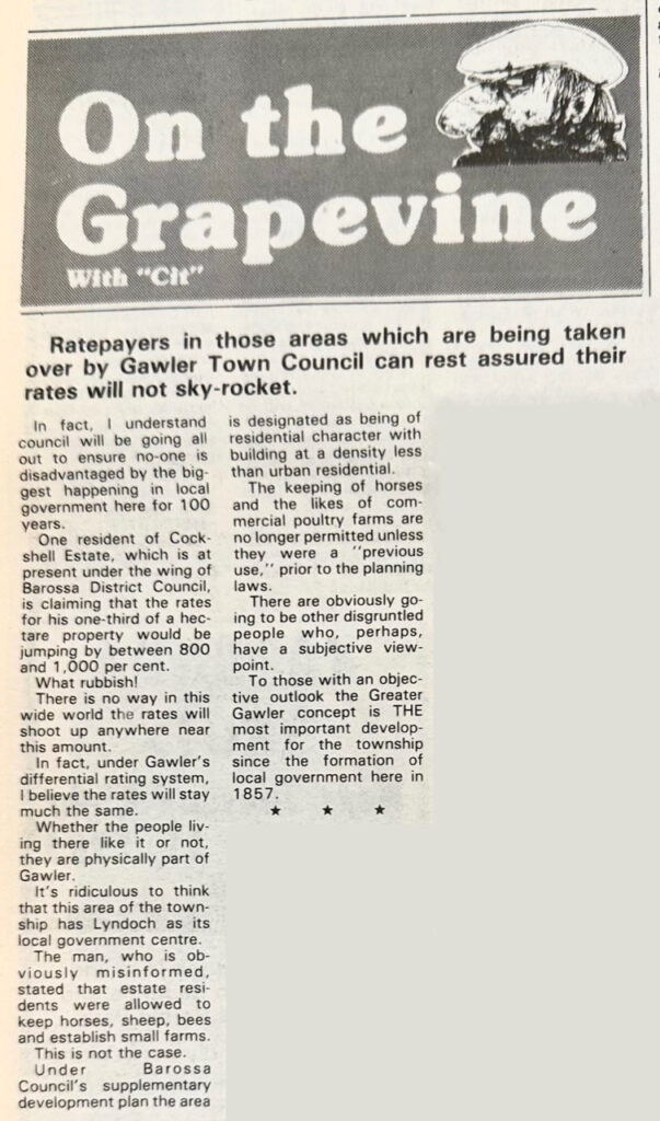
The Bunyip, September 5th, 1984.
While these can seem like the most obvious changes in the world from a top-down view (why would a Gawler East resident be paying their rates to a rural Council?), explaining those changes does require more nuance from the residents’ perspective.
I suspect that, in particular, the labelling of a move from “regional” to “metropolitan” can feel like a big change for people who made the decision to buy a house somewhere away from the city, hoping for lower rates (or looser agriculture restrictions, like this Gawler East resident).
In reality, most of these things will remain the same with a new Council. Much of it is based on state government standards (like land zoning or property value appraisal) that apply regardless of your Council. Still, the clearer you can explain the changes, the less stressful it will be for all involved.
The Aftermath
As the dust settled, it seems that affected residents also settled – I’m unaware of any notable instances of residents trying to revert the boundaries. However, there was still some discontent from people who didn’t feel the boundary change had gone far enough.
In 1987, the Bunyip asked former Mayor Cec. Creedon for his thoughts on the boundaries decision. While he was happy that it had all finally gone through, he did state that Gawler “should have been given more land to the north and west”. By the north, I suspect he meant Roseworthy, but I’m unsure which part of the west he was considering. Perhaps Angle Vale?
However, what really kicked the entire process off again was the creation of the suburb of Hewett in the early ’90s (heralded by the launch of Harkness Heights, a housing development there).
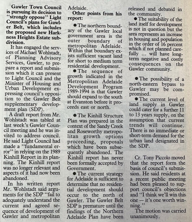
The Bunyip, September 1st, 1993.
The Light Council (to the protest of the Gawler Council of the time) had begun to build a suburb on the rural northern border of Gawler’s Council boundary, this time in Gawler Belt (the relevant section of which would later be renamed Hewett).
Two years later, the Gawler Council, led by Mayor Bruce Eastick (he first became Mayor in 1968, but this boundaries saga has gone on for so long that by this point, he has finished his 23-year term as local MP and returned to being Mayor), launched another push for larger boundaries that would create a buffer zone on Gawler’s borders:
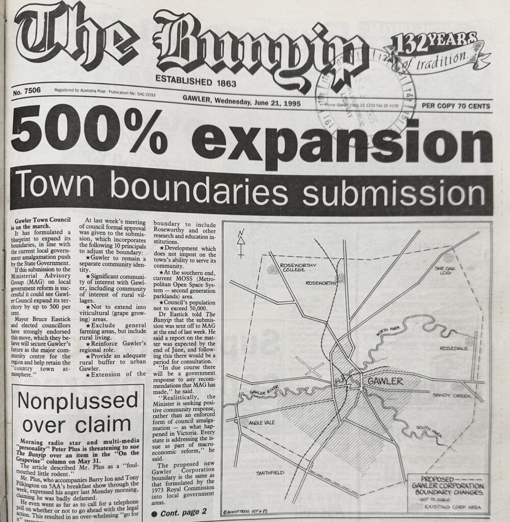
The Bunyip, June 21st, 1995.
You can read more about this in my blog post about 1995; it was an exciting year for local government boundaries, with the State Government pushing for Council amalgamations across the board.
This boundary reform dream continued to the next Mayor, Tony Piccolo, who pushed the idea of boundary change in his 2003 Mayoral Campaign, stating, “It is important that boundaries reflect community boundaries if local government is to be truly representative and effective”.
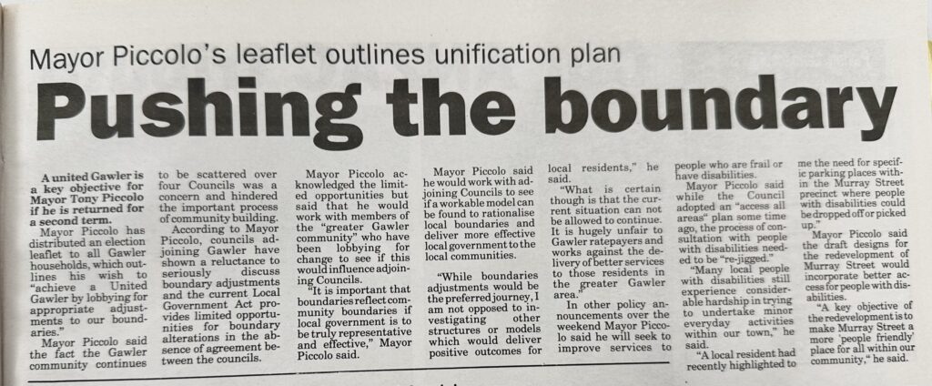
The Bunyip, April 30th, 2003.
This boundary push continued in various forms until 2019, when another change to how the State Government manages boundary requests led to a new official boundaries submission by the Town of Gawler.
Where we’re at now
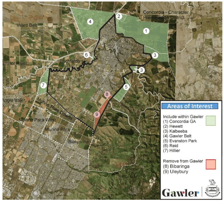
To complete the circle, I’ll briefly summarise the Town of Gawler’s 2019 boundary proposal, which is currently navigating the State Government’s boundary process. It totals nine suggested changes (some more dramatic than others) impacting three neighbouring Councils.
Barossa Council: Concordia (1) and Reid (3). This is a small area as current population goes (around 200 houses), but the major controversy here is about future growth. Concordia is earmarked for a population of ~24,000 in upcoming decades (around the same size as Gawler). Gawler contends that this upcoming Concordia development on its border should be built as part of ‘Greater Gawler’ rather than the Barossa region (though, of course, the Barossa Council disagrees).
Light Regional Council: Hewett (2), Gawler Belt (4) and Reid (6). This is the trickiest part of the proposal, as, unlike the others, this is about houses that already exist, mainly in Hewett, which has a population of approximately 3000 residents.
City of Playford: Evanston Park (5), Hillier (7), Bibiringa (8) and Uleybury (9). Two additions and two removals. This part of the proposal is completely non-controversial and is basically just cleaning up some edge cases where a Council only has a small slice of a suburb. It would be a net loss for Playford of 20 out of their ~42,000 houses, and they have had no objections thus far.
This Gawler Council proposal passed the early stages of the Boundaries Commission process and is currently in the mystical land of bureaucracy, awaiting further investigation. If I hear about a result, I’ll be sure to let you know.
Now, I know what you want to say. “Cody, this all sounds good, but if this boundary reform proposal goes through, Gawler’s boundaries will no longer look like a sideways-facing dog.”
I’ve also been puzzling over this significant concern, so to end my post, I’ll leave you with two potential new Gawler mascot concepts (based on the suggested boundaries) I made in five minutes just now in Microsoft Paint.

On the left, I’ve created a dinosaur-looking guy with a big tail (you have to tilt a little), whereas on the right, I’ve reimagined the new Council boundaries as a sort of horrifying deep-sea creature. I also had a third concept, “a little guy with a big hat who has tripped over his robes”, but tragically, I lack the artistic ability to bring this one to life.
That’s about it for my post today! If you enjoyed this post, check out the rest of my series on Gawler history!
Pingback: 1985 in Gawler's Election History - Cody Davies - Town of Gawler Elected Member